Google Maps adding cycling routes for Canadian cities
Cyclists in some of Canada's biggest cities will soon be able to use Google Maps to find the best way to get around by bicycle.
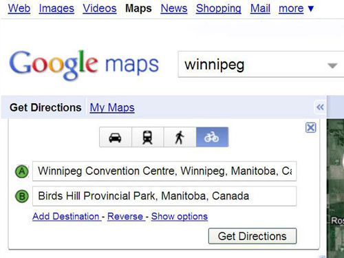
Cyclists in some of Canada’s biggest cities will soon be able to use Google Maps to find the best way to get around by bicycle. Google Canada is adding the feature, which had been available in the U.S. for some time, to its Google Maps program at maps.google.ca. Cyclists will be able to find cycling directions and bike trail data in Google Maps much like motorists already can, said Shannon Guymon of Google Canada. The system is being launched in Ottawa, Gatineau, Toronto, Edmonton, Vancouver, Calgary, Winnipeg, Kelowna and Waterloo.
The maps will be colour coded. Dark green that will indicate a dedicated bike-only trail, lighter green is a bike lane along a road and a dotted green line means roads that do not have bike lanes but tend to be used by cyclists. They can also be used to help cyclists avoid dangerous roads and hills if they wish.