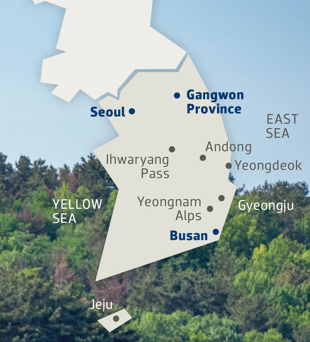
The Alps of South Korea
From Seoul to Busan, there is a range of places to ride, including peaceful valleys and leg-searing inclines
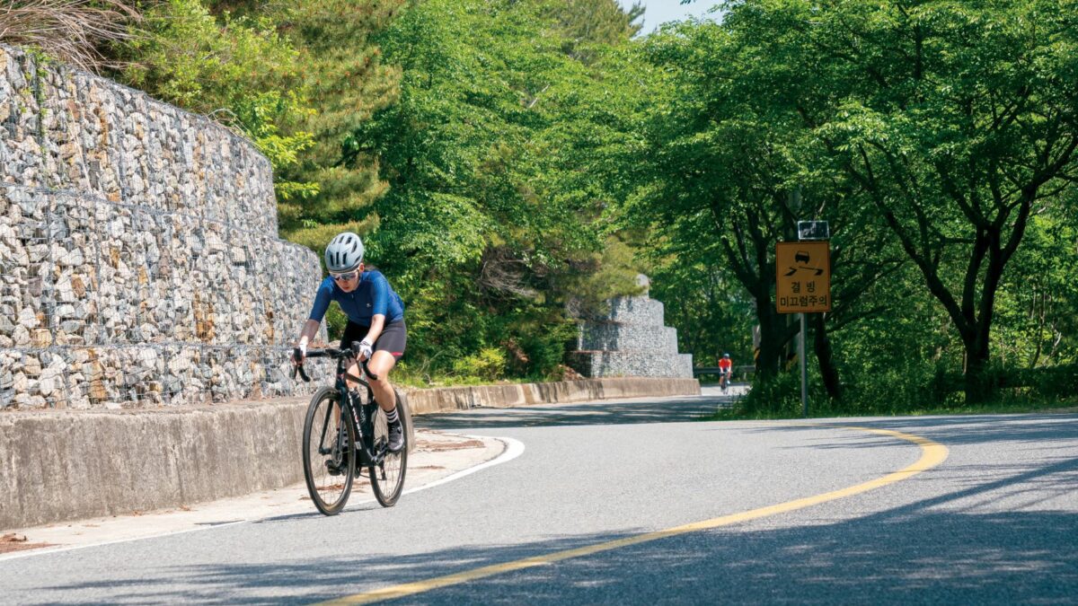 Photo by:
Courtesy TDA Global Cycling
Photo by:
Courtesy TDA Global Cycling
I was 1 km from the summit of what I thought was that last climb of the day. I was feeling good about the prospect of meeting the rest of the group at the lunch stop on time, possibly even ahead of schedule. Then, I felt the gradient rising sharply. The numbers on my head unit started ticking up: nine per cent, 10, then quickly 14 and 15 per cent as my cadence and forward progress slowed. With about 400 m to go to the summit, the computer flashed 18 per cent, before we settled on the 16 per cent range. I guess our guide had a good reason for wanting to shuttle the group most of the way to Busan on our final day of riding.
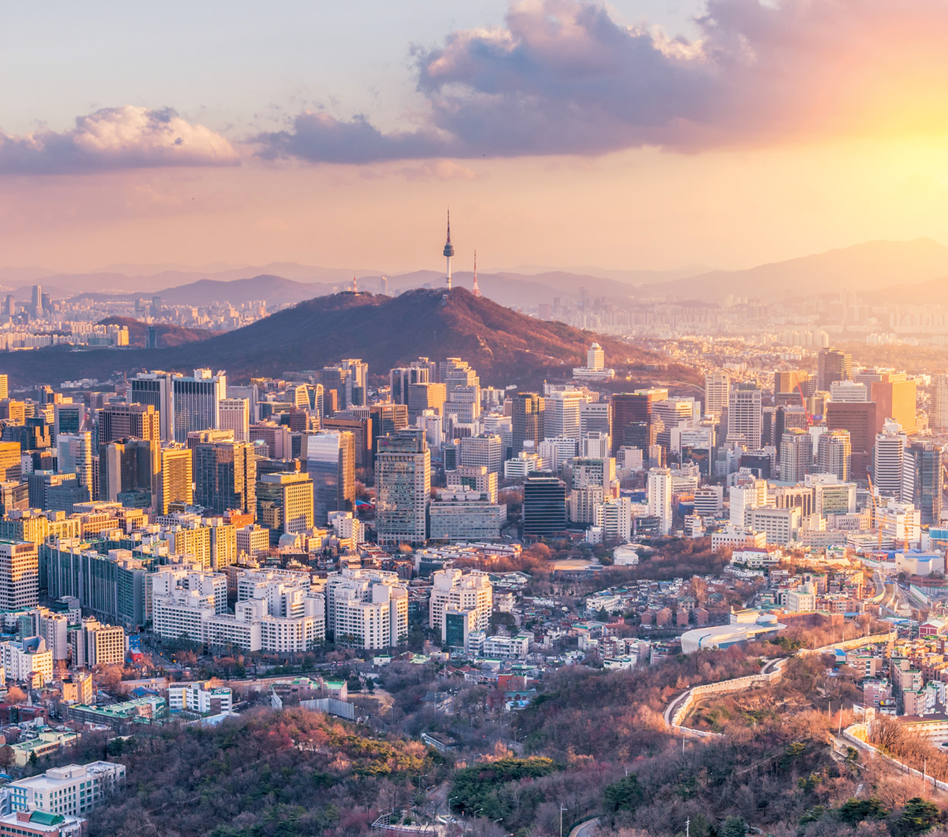
Six days earlier, I had flown to Seoul to sample the cycling in South Korea, specifically a dedicated cycleway that links the capital in the north to Busan, a major port city in the southeast. Landing in Seoul late after nearly 17 hours flying, I was too wired to go straight to bed. Seriously jet lagged, I wandered around the area by my hotel in search of food. In my late-night stumbling, I noticed a river and a wide path alongside it. It wasn’t until the next morning that I could see clearly that it was the Han River, the waterway that divides Seoul, and the wide path that is a veritable bike highway.
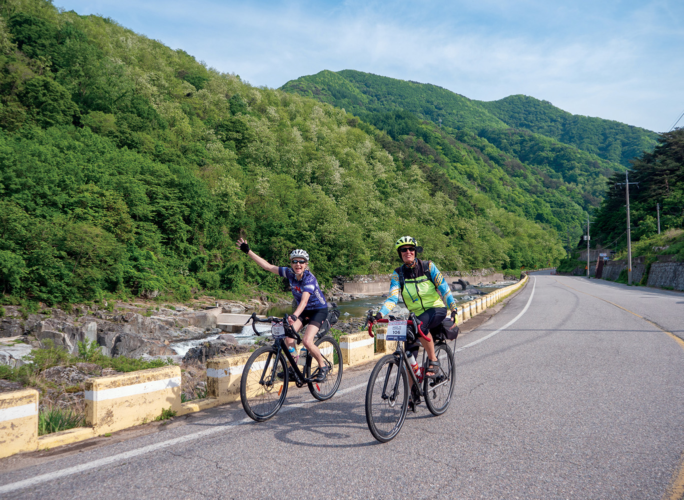 Image: Courtesy TDA Global Cycling[/caption]
After I had assembled my bike in the morning, I headed out for a shakedown ride. I got caught in heavy traffic, but then made a beeline for the river. The Hangang cycleway was completely and pleasantly segregated from the traffic and commotion of Seoul roads. Even late on a weekday morning, I saw a huge number of cyclists out, multiple pelotons of Rapha- and Maap-clad riders, along with plenty of more recreational cyclists on a wide variety of steeds.
I stopped at a local shop that a friend tipped me off to, Bike Makes Me Happy. There, co-owner Erica Kim told me more about the impressively large and diverse number of cyclists in South Korea. On any given morning in Seoul, there are multiple group rides headed out for morning world champs along the Hangang path and into the hills surrounding the Gyeongbokgung Palace, the old royal home. It’s no accident that both Rapha and Pas Normal Studios (among others) have dedicated brand stores in Seoul. After seeing the number of cyclists out, and the impressive infrastructure, I was even more curious to start our ride to Busan.
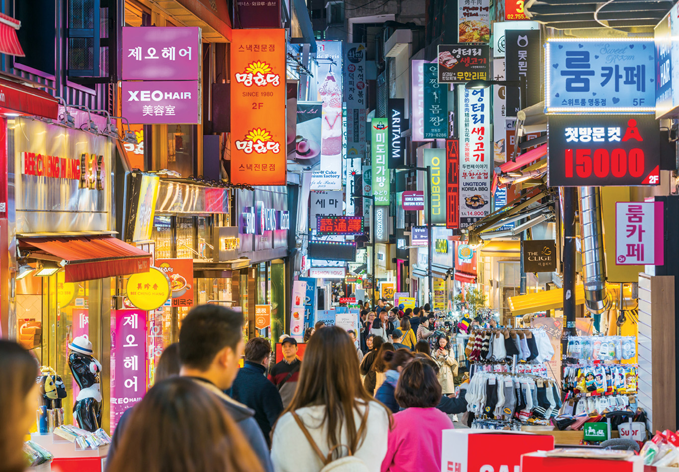
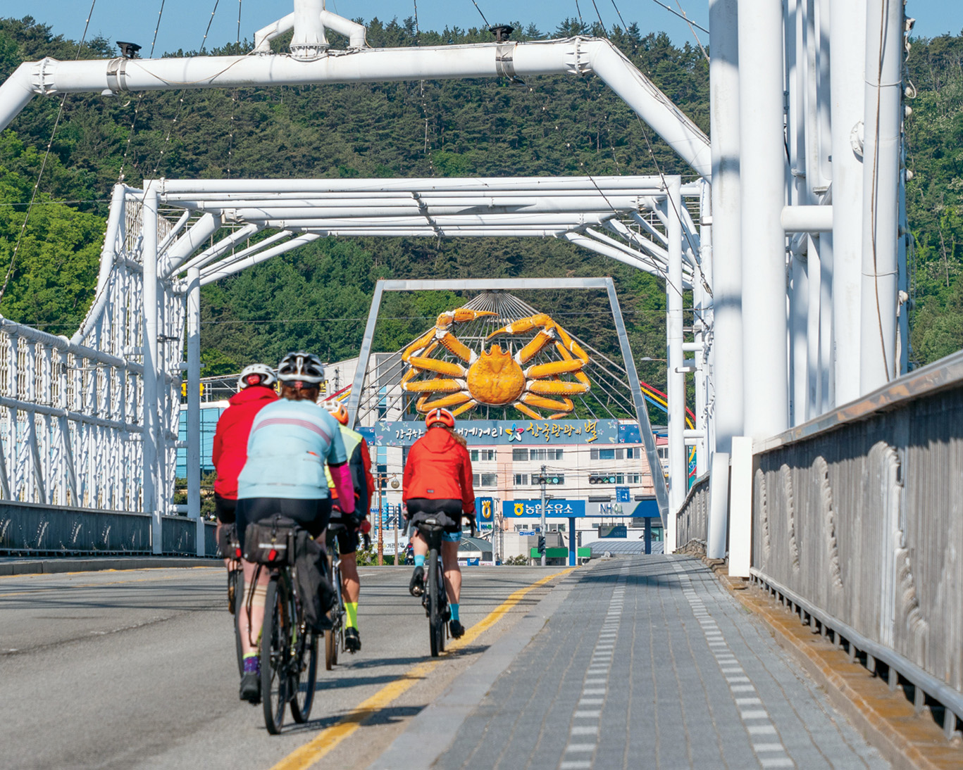 Image: Courtesy TDA Global Cycling
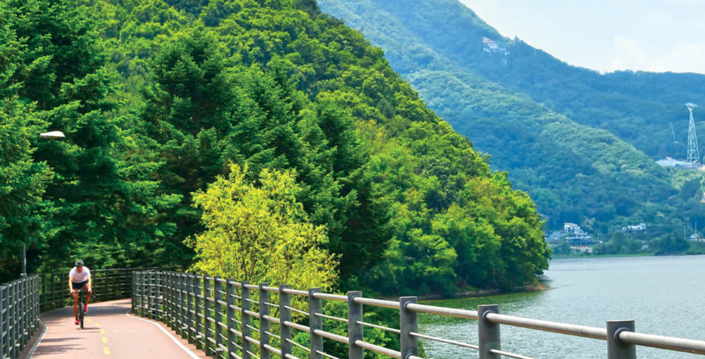
The next day, we pedalled a flat 30 km out of Seoul along the Hangang bike path. Our route parallelled the river, but we started to ride higher along the banks, giving us better views of the surrounding area. I saw a different side of South Korea, a contrast to the Blade Runner-like cityscape of Seoul as the scenery turned from dense thickets of skyscrapers to serene countryside and quiet roads. Since it was fall harvest, golden rice-paddy fields flanked the roads. If you swapped those fields for olive groves or vineyards, what I saw could pass for the roads and villages of Italy. Most of the route from Seoul to Busan lies in valleys that are surrounded by hills and mountains in all directions. That elevation beckoned me.
I kept asking our guide, Cambi Kim, when we would turn into the hills. My answer came the next day when we reached the midpoint of the route, the Ihwaryang Pass. A little more than 4-km long, with an average gradient of six per cent, the Ihwaryang is relatively modest as far as passes go, but it’s a highly sought after Strava segment since it’s the highpoint of one of the most popular cycling routes in South Korea. With fresh legs and motivation from a couple of days on the flats, I attacked the pass with my best Tadej Pogačar impersonation. The Ihwaryang is what I would call a feel-good climb: steep enough to make you feel like you are on a proper climb, but with a relatively gentle and consistent gradient that gives you a great sensation of speed. Your climbing abilities will be nicely flattered, and it’s over before any real suffering sets in. My solid middle-of-the-leaderboard effort only served to whet my appetite for more climbs.
The next morning, after a tour of a traditional village in Andong, a UNESCO heritage site, we deviated from the standard Seoul-Busan route with a transfer to take in more of what cycling in South Korea has to offer. We were deposited in Juwangsan National Park in the Cheongsong region, an area popular for climbing—of the rock and ice variety—and commonly referred to as the Yeongnam Alps. Among the cliffs and peaks that make for a mountaineer’s playground are plenty of roads that are ideal for riders looking for a challenge. First up were a couple of steep, punchy kickers, Juwangsan (Mount Juwang) and Gamabong (Gama Peak). At 10 and eight per cent average, I was happy they weren’t too long, with smooth tarmac that made them a pleasure to climb and even moreso to descend their sweeping switchbacks. Climbing the longer but shallower Sirubong (Siru Peak) in the late afternoon sun, with trees still green owing to the unseasonably warm autumn, made for a great end to a day in the “Alps.” From the top of the Sirubong, I tackled the long sweeping descent toward the seaside town of Yeongdeok, where we were staying for the night. My guide jokingly called it “king crab city” (no prize for guessing the local specialty). Over dinner, and still riding high from my day in the Alps, I told Kim I wanted to do more rides like that one. He got his phone and pulled up his Strava feed. He said that Gangwon province, to the north and east of Seoul, is where I want to go for the true giants. “Next trip,” he said with a shrug. With a couple days of scenic, albeit less demanding coastal rides on tap, I reluctantly bid the mountains goodbye and made a mental note to return, see more of the Yeongnam Alps and to go to Gangwon.
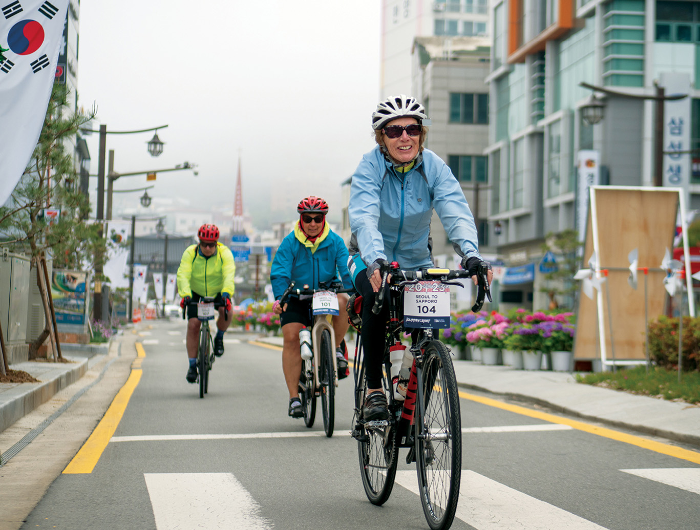 Image: Courtesy TDA Global Cycling
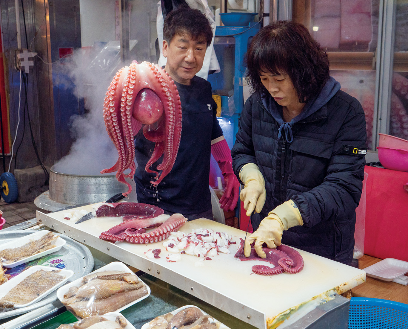 Image: Courtesy TDA Global Cycling
On our final day, we were scheduled to be shuttled from our hotel in Gyeongju, a historic city situated near the entrance of the Gyeongju National Park and the ranges it comprises, to start part way up a short climb, and then take a long gradual descent to rejoin the Seoul to Busan route for our final leg. Knowing this was my last chance to take on the Yeongnam Alps, I talked (more like begged, pleaded and cajoled) my guide into letting me skip the transfer to ride from the hotel and through the mountains to link up with the group at the lunch spot for the final leg into Busan. With a .GPX file loaded on my Garmin, and a stern warning from my guide that I was on my own without support, I set off from the hotel in Gyeongju. After 20 km, I left the edge of town and hit the base of Gamsan, a nice leg opener at just under 3 km and around six per cent gradient. Cresting Gamsan led to a shallow descent, into a false flat, and then a gradual 9-km drag, for which I earned the reward of a much sharper and twistier descent. This led to what I thought was the last climb of the day, a 5-km long stretch averaging eight per cent. No big deal, I thought. The last kilometre, however, kicked up well into double-digit grades, a big ask on tired legs. I somehow managed to stay upright while riding at barely walking pace. (Thank you 1:1 gearing!) Shortly after I crested the top, I received a text from my seemingly telepathic guide asking where I was. I fired back with a “just finished last climb, on final descent,” turned on location sharing and clipped in for a steep and fast descent toward lunch. A minute in, I got an alert from Kim with the message: “1 more climb” and the cry/laugh emoji. It turned out he hadn’t remembered the route correctly, and told me it was about 70 km or so to the meet-up spot. Actually, it was closer to 100 km with one more short but sharp kicker on tap for me before lunch. But I didn’t mind. After all, I came to South Korea to ride, and I plan to be back.
 Image: Courtesy TDA Global Cycling
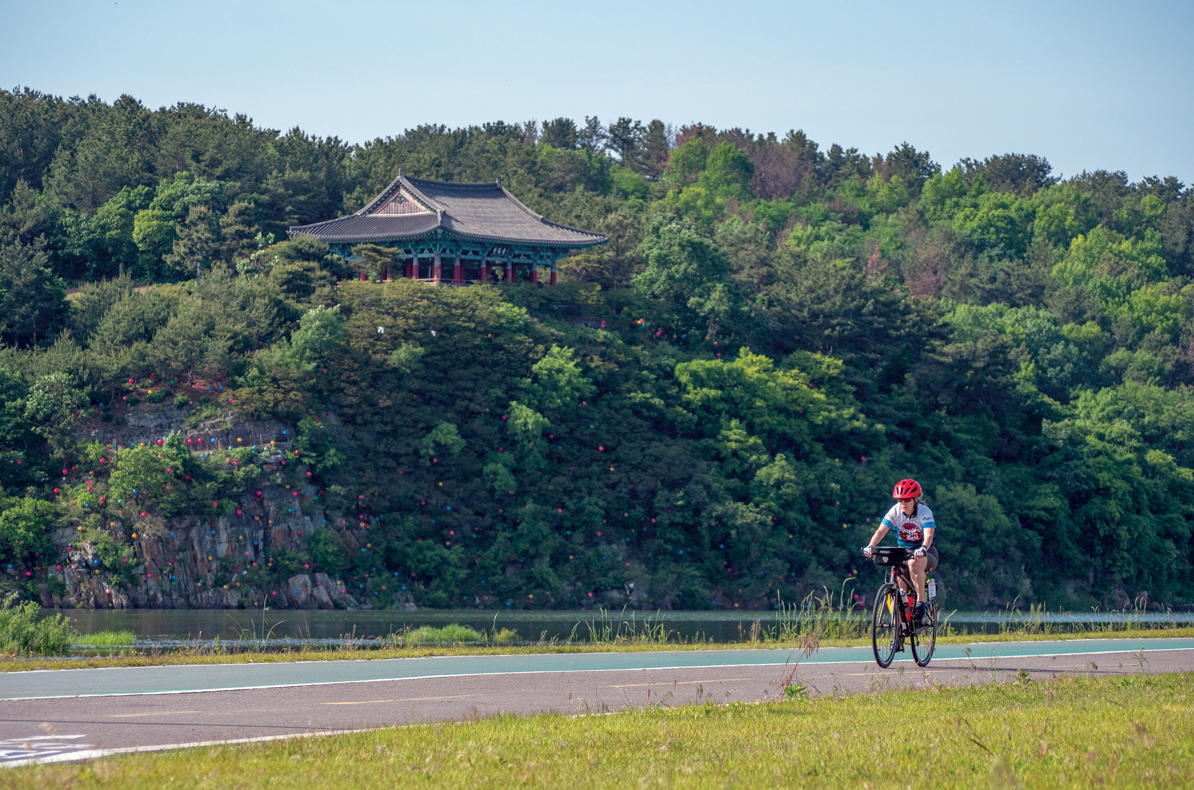 Image: Courtesy TDA Global Cycling
Details: South Korea
How to get there
Air Canada has daily flights to the Incheon International Airport, near Seoul. Direct flights are available from both Toronto Pearson International Airport and Vancouver International Airport.
When to go
The climate in Korea is not dissimilar to Southern Ontario. April to June (spring) and September to October (fall) bring mild conditions that are best for riding. Early April offers spectacular pink vistas of cherry blossoms. But, keep in mind that some of the higher peaks might still be inaccessible at this time of year because of snow. The harvest season has mellow temperatures and golden views of rice-paddy fields as far as the eye can see. It’s best to avoid July and August, with high heat and humidity, as well as jangma or the country’s rainy season.
Where to go
In addition to the Seoul to Busan route, which runs north to south, South Korea offers a rich menu of options for two-wheel adventures. For a more serious challenge, the Gangwon Province in the north is a climber’s paradise, featuring numerous climbs of 1,000 m, as well as giants such as Odaesan and Seoraksan. The area is host to the Seorak Gran Fondo (granfondo.kr) every May, where 5,000 cyclists congregate to challenge themselves on the 208-km course with more than 3,000 m of climbing. The Yeongnam Alps, to the south, offer equally numerous climbs with more moderate altitudes, and more temperate weather in the early and late seasons. For an easier pedal, consider a spin around Jeju Island, off the southern tip of the peninsula.
Where to find support
There are many bike shops throughout Seoul, but Bike Makes Me Happy (bikemakesmehappy.com) is a must for visiting cyclists. You can pick up any last-minute supplies you need. The proprietors Erica Kim and Hacheon Park are friendly, speak excellent English and have a wealth of inside information. Just try to not get too distracted by the collection of beautiful No. 22 and Richard Sachs custom bikes on display.
Another worthwhile stop is the Cheonhogong neighbourhood of Seoul, where there is an entire street filled with nothing but bike shops, with just about any spare parts you could possibly need.
While you can go the DIY route for cycling in South Korea, Canadian tour operator TDA Global Cycling (tdaglobalcycling.com) runs fully guided tours from Seoul, South Korea, to Sapporo in Japan. For local support, Teamax Adventure (teamaxadventure.com) has everything from fully guided tours to self-guided tours and support vehicle services by the day, to suit your needs.
Navigation know-how
Google Maps has limited functionality in South Korea, only offering reliable real-time routes for public transport. There are two popular map apps, Naver and Kakao, that South Koreans rely on, but both require some passing know-ledge of Korean. Apple Maps works decently well for getting around if you are using an iPhone. For navigating with your Garmin device, I found it best to download a base map from OpenStreetMap (garmin.bbbike.org).